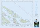
Maps showing Spalding Hill, Cowichan Land District, British Columbia
Spalding Hill is a Mountain located in Cowichan Land District, British Columbia and has an elevation of 79 meters.
- Latitude: 48° 45' 11'' North (decimal: 48.7530555)
- Longitude: 123° 12' 52'' West (decimal: -123.2144444)
- Topography Feature Category: Mountain
- Geographical Feature: Hill
- Canadian Province/Territory: British Columbia
- Elevation: 79 meters
- Location: Cowichan Land District
- Atlas of Canada Locator Map: Spalding Hill
- GPS Coordinate Locator Map: Spalding Hill Lat/Long
Spalding Hill NTS Map Sheets