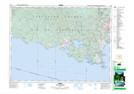
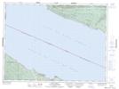
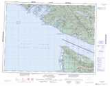
Maps showing Rockbottom Creek, Renfrew Land District, British Columbia
Rockbottom Creek is a River located in Renfrew Land District, British Columbia and has an elevation of 98 meters.
- Latitude: 48° 24' 49'' North (decimal: 48.4136111)
- Longitude: 124° 0' 47'' West (decimal: -124.013056)
- Topography Feature Category: River
- Geographical Feature: Creek
- Canadian Province/Territory: British Columbia
- Elevation: 98 meters
- Location: Renfrew Land District
- Atlas of Canada Locator Map: Rockbottom Creek
- GPS Coordinate Locator Map: Rockbottom Creek Lat/Long
Rockbottom Creek NTS Map Sheets