Maps showing Rocky Mountain Portage, Peace River Land District, British Columbia
Rocky Mountain Portage is a Road feature located in Peace River Land District, British Columbia.
- Latitude: 56° 2' North (decimal: 56.0332999)
- Longitude: 122° 6' West (decimal: -122.0999999)
- Topography Feature Category: Road feature
- Geographical Feature: Portage
- Canadian Province/Territory: British Columbia
- Location: Peace River Land District
- Atlas of Canada Locator Map: Rocky Mountain Portage
- GPS Coordinate Locator Map: Rocky Mountain Portage Lat/Long
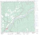
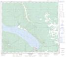
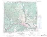
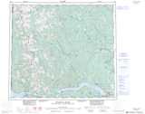
Rocky Mountain Portage NTS Map Sheets