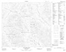
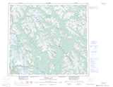
Maps showing Tony Creek, Cassiar Land District, British Columbia
Tony Creek is a River located in Cassiar Land District, British Columbia.
- Latitude: 56° 43' 28'' North (decimal: 56.7244444)
- Longitude: 128° 38' 16'' West (decimal: -128.6377777)
- Topography Feature Category: River
- Geographical Feature: Creek
- Canadian Province/Territory: British Columbia
- Location: Cassiar Land District
- Atlas of Canada Locator Map: Tony Creek
- GPS Coordinate Locator Map: Tony Creek Lat/Long
Tony Creek NTS Map Sheets