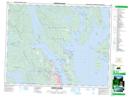
Maps showing Mount Lolo, Sayward Land District, British Columbia
Mount Lolo is a Mountain located in Sayward Land District, British Columbia and has an elevation of 77 meters.
- Latitude: 50° 8' 52'' North (decimal: 50.1477778)
- Longitude: 125° 20' 39'' West (decimal: -125.344167)
- Topography Feature Category: Mountain
- Geographical Feature: Mount
- Canadian Province/Territory: British Columbia
- Elevation: 77 meters
- Location: Sayward Land District
- Atlas of Canada Locator Map: Mount Lolo
- GPS Coordinate Locator Map: Mount Lolo Lat/Long
Mount Lolo NTS Map Sheets