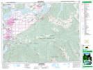
Maps showing Meadowland Park, New Westminster Land District, British Columbia
Meadowland Park is a Conservation area located in New Westminster Land District, British Columbia.
- Latitude: 49° 9' North (decimal: 49.1499999)
- Longitude: 121° 49' West (decimal: -121.8167000)
- Topography Feature Category: Conservation area
- Geographical Feature: Provincial Park
- Canadian Province/Territory: British Columbia
- Location: New Westminster Land District
- GPS Coordinate Locator Map: Meadowland Park Lat/Long