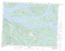
Maps showing Sparks Cone, Range 1 Coast Land District, British Columbia
Sparks Cone is a Mountain located in Range 1 Coast Land District, British Columbia and has an elevation of 177 meters.
- Latitude: 50° 28' 37'' North (decimal: 50.4769444)
- Longitude: 125° 56' 40'' West (decimal: -125.944444)
- Topography Feature Category: Mountain
- Geographical Feature: Cone
- Canadian Province/Territory: British Columbia
- Elevation: 177 meters
- Location: Range 1 Coast Land District
- Atlas of Canada Locator Map: Sparks Cone
- GPS Coordinate Locator Map: Sparks Cone Lat/Long
Sparks Cone NTS Map Sheets