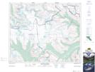
Maps showing Snow Dome, Kootenay Land District, British Columbia
Snow Dome is a Mountain located in Kootenay Land District, British Columbia.
- Latitude: 52° 11' 15'' North (decimal: 52.1875)
- Longitude: 117° 18' 59'' West (decimal: -117.3163888)
- Topography Feature Category: Mountain
- Geographical Feature: Mountain
- Canadian Province/Territory: British Columbia
- Location: Kootenay Land District
- Atlas of Canada Locator Map: Snow Dome
- GPS Coordinate Locator Map: Snow Dome Lat/Long
Snow Dome NTS Map Sheets