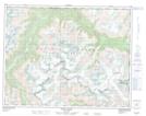
Maps showing Transfiguration Peak, Coast Land District, British Columbia
Transfiguration Peak is a Mountain located in Coast Land District, British Columbia.
- Latitude: 50° 53' 41'' North (decimal: 50.8947222)
- Longitude: 124° 14' 28'' West (decimal: -124.241111)
- Topography Feature Category: Mountain
- Geographical Feature: Peak
- Canadian Province/Territory: British Columbia
- Location: Coast Land District
- Atlas of Canada Locator Map: Transfiguration Peak
- GPS Coordinate Locator Map: Transfiguration Peak Lat/Long
Transfiguration Peak NTS Map Sheets