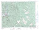
Maps showing Silver Peak, New Westminster Land District, British Columbia
Silver Peak is a Mountain located in New Westminster Land District, British Columbia and has an elevation of 1719 meters.
- Latitude: 49° 18' 15'' North (decimal: 49.3041666)
- Longitude: 121° 27' 45'' West (decimal: -121.4624999)
- Topography Feature Category: Mountain
- Geographical Feature: Peak
- Canadian Province/Territory: British Columbia
- Elevation: 1719 meters
- Location: New Westminster Land District
- Atlas of Canada Locator Map: Silver Peak
- GPS Coordinate Locator Map: Silver Peak Lat/Long