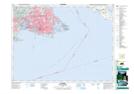
Maps showing Quicks Bottom, Lake Land District, British Columbia
Quicks Bottom is a Low vegetation located in Lake Land District, British Columbia and has an elevation of 36 meters.
- Latitude: 48° 29' 50'' North (decimal: 48.4972218)
- Longitude: 123° 24' 7'' West (decimal: -123.401944)
- Topography Feature Category: Low vegetation
- Geographical Feature: Flats
- Canadian Province/Territory: British Columbia
- Elevation: 36 meters
- Location: Lake Land District
- Atlas of Canada Locator Map: Quicks Bottom
- GPS Coordinate Locator Map: Quicks Bottom Lat/Long