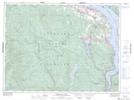
Maps showing Memory Island Park, Malahat Land District, British Columbia
Memory Island Park is a Conservation area located in Malahat Land District, British Columbia and has an elevation of 125 meters.
- Latitude: 48° 36' 50'' North (decimal: 48.6138999)
- Longitude: 123° 38' 00'' West (decimal: -123.6333000)
- Topography Feature Category: Conservation area
- Geographical Feature: Provincial Park
- Canadian Province/Territory: British Columbia
- Elevation: 125 meters
- Location: Malahat Land District
- Atlas of Canada Locator Map: Memory Island Park
- GPS Coordinate Locator Map: Memory Island Park Lat/Long
Memory Island Park NTS Map Sheets