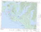
Maps showing Woman Island, Clayoquot Land District, British Columbia
Woman Island is a Island located in Clayoquot Land District, British Columbia and has an elevation of 11 meters.
- Latitude: 49° 12' 20'' North (decimal: 49.2055555)
- Longitude: 125° 37' 17'' West (decimal: -125.6213888)
- Topography Feature Category: Island
- Geographical Feature: Island
- Canadian Province/Territory: British Columbia
- Elevation: 11 meters
- Location: Clayoquot Land District
- Atlas of Canada Locator Map: Woman Island
- GPS Coordinate Locator Map: Woman Island Lat/Long
Woman Island NTS Map Sheets