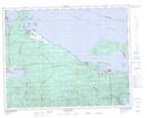
Maps showing Narrow Island, Rupert Land District, British Columbia
Narrow Island is a Island located in Rupert Land District, British Columbia.
- Latitude: 50° 35' 40'' North (decimal: 50.5944444)
- Longitude: 127° 29' 54'' West (decimal: -127.498333)
- Topography Feature Category: Island
- Geographical Feature: Island
- Canadian Province/Territory: British Columbia
- Location: Rupert Land District
- GPS Coordinate Locator Map: Narrow Island Lat/Long
Narrow Island NTS Map Sheets