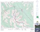
Maps showing Vera Lake, Kootenay Land District, British Columbia
Vera Lake is a Lake located in Kootenay Land District, British Columbia.
- Latitude: 51° 22' North (decimal: 51.3666999)
- Longitude: 116° 23' West (decimal: -116.3832999)
- Topography Feature Category: Lake
- Geographical Feature: Lake
- Canadian Province/Territory: British Columbia
- Location: Kootenay Land District
- GPS Coordinate Locator Map: Vera Lake Lat/Long