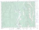
Maps showing Twin Lakes, Kootenay Land District, British Columbia
Twin Lakes is a Lake located in Kootenay Land District, British Columbia.
- Latitude: 49° 55' 20'' North (decimal: 49.9222000)
- Longitude: 115° 37' 40'' West (decimal: -115.6278000)
- Topography Feature Category: Lake
- Geographical Feature: Lakes
- Canadian Province/Territory: British Columbia
- Location: Kootenay Land District
- GPS Coordinate Locator Map: Twin Lakes Lat/Long
Twin Lakes NTS Map Sheets