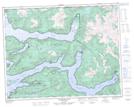
Maps showing Charles Hill, Range 1 Coast Land District, British Columbia
Charles Hill is a Mountain located in Range 1 Coast Land District, British Columbia and has an elevation of 118 meters.
- Latitude: 50° 55' 55'' North (decimal: 50.9319444)
- Longitude: 126° 20' 34'' West (decimal: -126.342778)
- Topography Feature Category: Mountain
- Geographical Feature: Hill
- Canadian Province/Territory: British Columbia
- Elevation: 118 meters
- Location: Range 1 Coast Land District
- Atlas of Canada Locator Map: Charles Hill
- GPS Coordinate Locator Map: Charles Hill Lat/Long
Charles Hill NTS Map Sheets