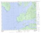
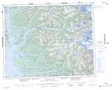
Maps showing Base Hill, Range 2 Coast Land District, British Columbia
Base Hill is a Mountain located in Range 2 Coast Land District, British Columbia and has an elevation of 97 meters.
- Latitude: 51° 20' 46'' North (decimal: 51.3461111)
- Longitude: 127° 44' 37'' West (decimal: -127.743611)
- Topography Feature Category: Mountain
- Geographical Feature: Hill
- Canadian Province/Territory: British Columbia
- Elevation: 97 meters
- Location: Range 2 Coast Land District
- Atlas of Canada Locator Map: Base Hill
- GPS Coordinate Locator Map: Base Hill Lat/Long
Base Hill NTS Map Sheets