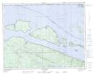
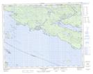
Maps showing Duval Point, Rupert Land District, British Columbia
Duval Point is a Cape located in Rupert Land District, British Columbia and has an elevation of 4 meters.
- Latitude: 50° 46' 10'' North (decimal: 50.7694444)
- Longitude: 127° 29' 8'' West (decimal: -127.485556)
- Topography Feature Category: Cape
- Geographical Feature: Point
- Canadian Province/Territory: British Columbia
- Elevation: 4 meters
- Location: Rupert Land District
- Atlas of Canada Locator Map: Duval Point
- GPS Coordinate Locator Map: Duval Point Lat/Long
Duval Point NTS Map Sheets