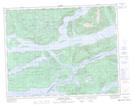
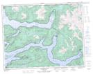
Maps showing Echo Bay Marine Park, Range 1 Coast Land District, British Columbia
Echo Bay Marine Park is a Conservation area located in Range 1 Coast Land District, British Columbia and has an elevation of 53 meters.
- Latitude: 50° 45' 3'' North (decimal: 50.7508333)
- Longitude: 126° 29' 41'' West (decimal: -126.494722)
- Topography Feature Category: Conservation area
- Geographical Feature: Provincial Marine Park
- Canadian Province/Territory: British Columbia
- Elevation: 53 meters
- Location: Range 1 Coast Land District
- Atlas of Canada Locator Map: Echo Bay Marine Park
- GPS Coordinate Locator Map: Echo Bay Marine Park Lat/Long
Echo Bay Marine Park NTS Map Sheets