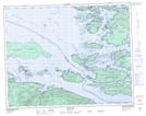
Maps showing Mount Holdsworth, Rupert Land District, British Columbia
Mount Holdsworth is a Mountain located in Rupert Land District, British Columbia and has an elevation of 670 meters.
- Latitude: 50° 30' 49'' North (decimal: 50.5136111)
- Longitude: 126° 55' 19'' West (decimal: -126.921944)
- Topography Feature Category: Mountain
- Geographical Feature: Mount
- Canadian Province/Territory: British Columbia
- Elevation: 670 meters
- Location: Rupert Land District
- Atlas of Canada Locator Map: Mount Holdsworth
- GPS Coordinate Locator Map: Mount Holdsworth Lat/Long
Mount Holdsworth NTS Map Sheets