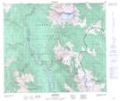
Maps showing Tuatoosho Peak, Range 5 Coast Land District, British Columbia
Tuatoosho Peak is a Mountain located in Range 5 Coast Land District, British Columbia.
- Latitude: 54° 58' 6'' North (decimal: 54.9683333)
- Longitude: 128° 10' 53'' West (decimal: -128.1813888)
- Topography Feature Category: Mountain
- Geographical Feature: Peak
- Canadian Province/Territory: British Columbia
- Location: Range 5 Coast Land District
- Atlas of Canada Locator Map: Tuatoosho Peak
- GPS Coordinate Locator Map: Tuatoosho Peak Lat/Long