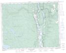
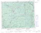
Maps showing Dunn Lake, Kamloops Division Yale Land District, British Columbia
Dunn Lake is a Lake located in Kamloops Division Yale Land District, British Columbia and has an elevation of 477 meters.
- Latitude: 51° 26' 2'' North (decimal: 51.4338889)
- Longitude: 120° 7' 49'' West (decimal: -120.130278)
- Topography Feature Category: Lake
- Geographical Feature: Lake
- Canadian Province/Territory: British Columbia
- Elevation: 477 meters
- Location: Kamloops Division Yale Land District
- Atlas of Canada Locator Map: Dunn Lake
- GPS Coordinate Locator Map: Dunn Lake Lat/Long
Dunn Lake NTS Map Sheets