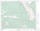
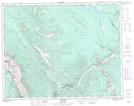
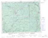
Maps showing Edge Hills, Lillooet Land District, British Columbia
Edge Hills is a Mountain located in Lillooet Land District, British Columbia and has an elevation of 1241 meters.
- Latitude: 51° 7' 53'' North (decimal: 51.1313889)
- Longitude: 121° 57' 8'' West (decimal: -121.952222)
- Topography Feature Category: Mountain
- Geographical Feature: Hills
- Canadian Province/Territory: British Columbia
- Elevation: 1241 meters
- Location: Lillooet Land District
- Atlas of Canada Locator Map: Edge Hills
- GPS Coordinate Locator Map: Edge Hills Lat/Long
Edge Hills NTS Map Sheets