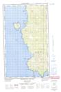
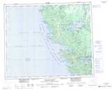
Maps showing Beehive Hill, Queen Charlotte Land District, British Columbia
Beehive Hill is a Mountain located in Queen Charlotte Land District, British Columbia and has an elevation of 25 meters.
- Latitude: 53° 56' 6'' North (decimal: 53.9350000)
- Longitude: 133° 7' 46'' West (decimal: -133.1294444)
- Topography Feature Category: Mountain
- Geographical Feature: Hill
- Canadian Province/Territory: British Columbia
- Elevation: 25 meters
- Location: Queen Charlotte Land District
- Atlas of Canada Locator Map: Beehive Hill
- GPS Coordinate Locator Map: Beehive Hill Lat/Long
Beehive Hill NTS Map Sheets