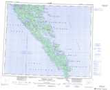
Maps showing Lyman Point, Queen Charlotte Land District, British Columbia
Lyman Point is a Cape located in Queen Charlotte Land District, British Columbia and has an elevation of 23 meters.
- Latitude: 52° 5' 37'' North (decimal: 52.0936111)
- Longitude: 130° 56' 14'' West (decimal: -130.937222)
- Topography Feature Category: Cape
- Geographical Feature: Point
- Canadian Province/Territory: British Columbia
- Elevation: 23 meters
- Location: Queen Charlotte Land District
- Atlas of Canada Locator Map: Lyman Point
- GPS Coordinate Locator Map: Lyman Point Lat/Long
Lyman Point NTS Map Sheets