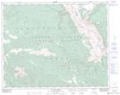
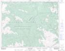
Maps showing Nine Mile Ridge, Lillooet Land District, British Columbia
Nine Mile Ridge is a Mountain located in Lillooet Land District, British Columbia and has an elevation of 2017 meters.
- Latitude: 51° 6' 36'' North (decimal: 51.11)
- Longitude: 122° 27' 6'' West (decimal: -122.451667)
- Topography Feature Category: Mountain
- Geographical Feature: Ridge
- Canadian Province/Territory: British Columbia
- Elevation: 2017 meters
- Location: Lillooet Land District
- Atlas of Canada Locator Map: Nine Mile Ridge
- GPS Coordinate Locator Map: Nine Mile Ridge Lat/Long
Nine Mile Ridge NTS Map Sheets