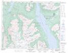
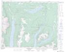
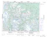
Maps showing Tatlayoko Lake, Coast Land District, British Columbia
Tatlayoko Lake is a Lake located in Coast Land District, British Columbia and has an elevation of 838 meters.
- Latitude: 51° 32' 47'' North (decimal: 51.5463889)
- Longitude: 124° 24' 53'' West (decimal: -124.414722)
- Topography Feature Category: Lake
- Geographical Feature: Lake
- Canadian Province/Territory: British Columbia
- Elevation: 838 meters
- Location: Coast Land District
- Atlas of Canada Locator Map: Tatlayoko Lake
- GPS Coordinate Locator Map: Tatlayoko Lake Lat/Long
Tatlayoko Lake NTS Map Sheets