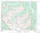
Maps showing Yohetta Valley, Lillooet Land District, British Columbia
Yohetta Valley is a Valley located in Lillooet Land District, British Columbia.
- Latitude: 51° 14' 00'' North (decimal: 51.2333333)
- Longitude: 123° 49' 0'' West (decimal: -123.816667)
- Topography Feature Category: Valley
- Geographical Feature: Valley
- Canadian Province/Territory: British Columbia
- Location: Lillooet Land District
- GPS Coordinate Locator Map: Yohetta Valley Lat/Long
Yohetta Valley NTS Map Sheets