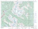
Maps showing Réserve indienne Baptiste Smith 1B, New Westminster Land District, British Columbia
Réserve indienne Baptiste Smith 1B is a Indian Reserve located in New Westminster Land District, British Columbia and has an elevation of 234 meters.
- Latitude: 50° 3' North (decimal: 50.0499998)
- Longitude: 122° 32' West (decimal: -122.5333333)
- Topography Feature Category: Indian Reserve
- Geographical Feature: Réserve indienne
- Canadian Province/Territory: British Columbia
- Elevation: 234 meters
- Location: New Westminster Land District
- Atlas of Canada Locator Map: Réserve indienne Baptiste Smith 1B
- GPS Coordinate Locator Map: Réserve indienne Baptiste Smith 1B Lat/Long