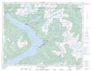
Maps showing Swaywelat Indian Reserve 12A, New Westminster Land District, British Columbia
Swaywelat Indian Reserve 12A is a Indian Reserve located in New Westminster Land District, British Columbia.
- Latitude: 50° 9' 45'' North (decimal: 50.1625000)
- Longitude: 123° 51' 00'' West (decimal: -123.8499999)
- Topography Feature Category: Indian Reserve
- Geographical Feature: Indian Reserve
- Canadian Province/Territory: British Columbia
- Location: New Westminster Land District
- GPS Coordinate Locator Map: Swaywelat Indian Reserve 12A Lat/Long
Swaywelat Indian Reserve 12A NTS Map Sheets