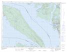
Maps showing Bargain Harbour Indian Reserve 24, New Westminster Land District, British Columbia
Bargain Harbour Indian Reserve 24 is a Indian Reserve located in New Westminster Land District, British Columbia.
- Latitude: 49° 36' 20'' North (decimal: 49.6056000)
- Longitude: 124° 1' 15'' West (decimal: -124.0207999)
- Topography Feature Category: Indian Reserve
- Geographical Feature: Indian Reserve
- Canadian Province/Territory: British Columbia
- Location: New Westminster Land District
- GPS Coordinate Locator Map: Bargain Harbour Indian Reserve 24 Lat/Long
Bargain Harbour Indian Reserve 24 NTS Map Sheets