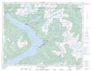
Maps showing Réserve indienne Chelohsin 13, British Columbia
Réserve indienne Chelohsin 13 is a Indian Reserve located in British Columbia.
- Latitude: 50° 8' 30'' North (decimal: 50.1417000)
- Longitude: 123° 48' 40'' West (decimal: -123.8111000)
- Topography Feature Category: Indian Reserve
- Geographical Feature: Réserve indienne
- Canadian Province/Territory: British Columbia
- GPS Coordinate Locator Map: Réserve indienne Chelohsin 13 Lat/Long
Réserve indienne Chelohsin 13 NTS Map Sheets