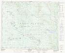
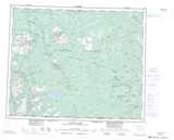
Maps showing Réserve indienne Agats Meadow 8, Range 3 Coast Land District, British Columbia
Réserve indienne Agats Meadow 8 is a Indian Reserve located in Range 3 Coast Land District, British Columbia.
- Latitude: 52° 17' 00'' North (decimal: 52.2833000)
- Longitude: 124° 9' 40'' West (decimal: -124.1610999)
- Topography Feature Category: Indian Reserve
- Geographical Feature: Réserve indienne
- Canadian Province/Territory: British Columbia
- Location: Range 3 Coast Land District
- Atlas of Canada Locator Map: Réserve indienne Agats Meadow 8
- GPS Coordinate Locator Map: Réserve indienne Agats Meadow 8 Lat/Long
Réserve indienne Agats Meadow 8 NTS Map Sheets