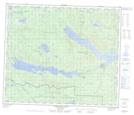
Maps showing Cunningham Lake Indian Reserve 11, Coast Land District, British Columbia
Cunningham Lake Indian Reserve 11 is a Indian Reserve located in Coast Land District, British Columbia.
- Latitude: 54° 35' 00'' North (decimal: 54.5833333)
- Longitude: 125° 15' 37'' West (decimal: -125.260278)
- Topography Feature Category: Indian Reserve
- Geographical Feature: Indian Reserve
- Canadian Province/Territory: British Columbia
- Location: Coast Land District
- GPS Coordinate Locator Map: Cunningham Lake Indian Reserve 11 Lat/Long
Cunningham Lake Indian Reserve 11 NTS Map Sheets