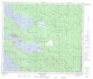
Maps showing Réserve indienne Pinchie Lake 12, Coast Land District, British Columbia
Réserve indienne Pinchie Lake 12 is a Indian Reserve located in Coast Land District, British Columbia.
- Latitude: 54° 37' North (decimal: 54.6166999)
- Longitude: 124° 27' West (decimal: -124.4499999)
- Topography Feature Category: Indian Reserve
- Geographical Feature: Réserve indienne
- Canadian Province/Territory: British Columbia
- Location: Coast Land District
- GPS Coordinate Locator Map: Réserve indienne Pinchie Lake 12 Lat/Long
Réserve indienne Pinchie Lake 12 NTS Map Sheets