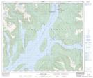
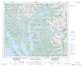
Maps showing Kuaste (Mud Bay)(Kildala Arm) Indian Reserve 8, Range 4 Coast Land District, British Columbia
Kuaste (Mud Bay)(Kildala Arm) Indian Reserve 8 is a Indian Reserve located in Range 4 Coast Land District, British Columbia.
- Latitude: 53° 52' North (decimal: 53.8667000)
- Longitude: 128° 41' West (decimal: -128.6832999)
- Topography Feature Category: Indian Reserve
- Geographical Feature: Indian Reserve
- Canadian Province/Territory: British Columbia
- Location: Range 4 Coast Land District
- Atlas of Canada Locator Map: Kuaste (Mud Bay)(Kildala Arm) Indian Reserve 8
- GPS Coordinate Locator Map: Kuaste (Mud Bay)(Kildala Arm) Indian Reserve 8 Lat/Long
Kuaste (Mud Bay)(Kildala Arm) Indian Reserve 8 NTS Map Sheets