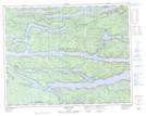
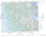
Maps showing Tsai-kwi-ee Indian Reserve 13, Range 2 Coast Land District, British Columbia
Tsai-kwi-ee Indian Reserve 13 is a Indian Reserve located in Range 2 Coast Land District, British Columbia.
- Latitude: 51° 10' North (decimal: 51.1666999)
- Longitude: 127° 25' West (decimal: -127.4167000)
- Topography Feature Category: Indian Reserve
- Geographical Feature: Indian Reserve
- Canadian Province/Territory: British Columbia
- Location: Range 2 Coast Land District
- Atlas of Canada Locator Map: Tsai-kwi-ee Indian Reserve 13
- GPS Coordinate Locator Map: Tsai-kwi-ee Indian Reserve 13 Lat/Long
Tsai-kwi-ee Indian Reserve 13 NTS Map Sheets