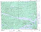
Maps showing Pa-cat'l-lin-ne Indian Reserve 3, Rupert Land District, British Columbia
Pa-cat'l-lin-ne Indian Reserve 3 is a Indian Reserve located in Rupert Land District, British Columbia and has an elevation of 32 meters.
- Latitude: 50° 38' North (decimal: 50.6332999)
- Longitude: 127° 59' West (decimal: -127.9833000)
- Topography Feature Category: Indian Reserve
- Geographical Feature: Indian Reserve
- Canadian Province/Territory: British Columbia
- Elevation: 32 meters
- Location: Rupert Land District
- Atlas of Canada Locator Map: Pa-cat'l-lin-ne Indian Reserve 3
- GPS Coordinate Locator Map: Pa-cat'l-lin-ne Indian Reserve 3 Lat/Long