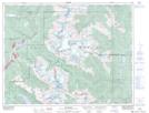
Maps showing Alta Lake, New Westminster Land District, British Columbia
Alta Lake is a Unincorporated area located in New Westminster Land District, British Columbia.
- Latitude: 50° 8' 30'' North (decimal: 50.1416666)
- Longitude: 122° 57' 20'' West (decimal: -122.9555555)
- Topography Feature Category: Unincorporated area
- Geographical Feature: Former Post Office
- Canadian Province/Territory: British Columbia
- Location: New Westminster Land District
- GPS Coordinate Locator Map: Alta Lake Lat/Long