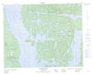
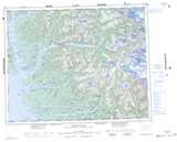
Maps showing Hat Island, Range 2 Coast Land District, British Columbia
Hat Island is a Island located in Range 2 Coast Land District, British Columbia.
- Latitude: 51° 43' 36'' North (decimal: 51.7266666)
- Longitude: 127° 59' 56'' West (decimal: -127.9988888)
- Topography Feature Category: Island
- Geographical Feature: Island
- Canadian Province/Territory: British Columbia
- Location: Range 2 Coast Land District
- Atlas of Canada Locator Map: Hat Island
- GPS Coordinate Locator Map: Hat Island Lat/Long
Hat Island NTS Map Sheets