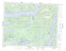
Maps showing Mount Shute, Range 1 Coast Land District, British Columbia
Mount Shute is a Mountain located in Range 1 Coast Land District, British Columbia.
- Latitude: 50° 32' 25'' North (decimal: 50.5402778)
- Longitude: 125° 48' 9'' West (decimal: -125.8025)
- Topography Feature Category: Mountain
- Geographical Feature: Mount
- Canadian Province/Territory: British Columbia
- Location: Range 1 Coast Land District
- Atlas of Canada Locator Map: Mount Shute
- GPS Coordinate Locator Map: Mount Shute Lat/Long
Mount Shute NTS Map Sheets