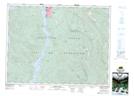
Maps showing The Hump, Cameron Land District, British Columbia
The Hump is a Mountain located in Cameron Land District, British Columbia.
- Latitude: 49° 14' 00'' North (decimal: 49.2333000)
- Longitude: 124° 35' 30'' West (decimal: -124.5917000)
- Topography Feature Category: Mountain
- Geographical Feature: Mountain
- Canadian Province/Territory: British Columbia
- Location: Cameron Land District
- GPS Coordinate Locator Map: The Hump Lat/Long
The Hump NTS Map Sheets