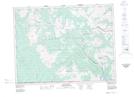
Maps showing La Coulotte Peak, British Columbia
La Coulotte Peak is a Mountain located in British Columbia and has an elevation of 2092 meters.
- Latitude: 49° 12' 1'' North (decimal: 49.2002777)
- Longitude: 114° 19' 6'' West (decimal: -114.3183333)
- Topography Feature Category: Mountain
- Geographical Feature: Peak
- Canadian Province/Territory: British Columbia
- Elevation: 2092 meters
- Atlas of Canada Locator Map: La Coulotte Peak
- GPS Coordinate Locator Map: La Coulotte Peak Lat/Long