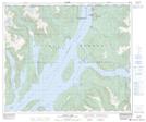
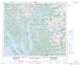
Maps showing Haisla, Range 4 Coast Land District, British Columbia
Haisla is a Unincorporated area located in Range 4 Coast Land District, British Columbia.
- Latitude: 53° 58' 50'' North (decimal: 53.980556)
- Longitude: 128° 38' 50'' West (decimal: -128.64722)
- Topography Feature Category: Unincorporated area
- Geographical Feature: Post Office
- Canadian Province/Territory: British Columbia
- Location: Range 4 Coast Land District
- Atlas of Canada Locator Map: Haisla
- GPS Coordinate Locator Map: Haisla Lat/Long
Haisla NTS Map Sheets