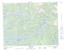
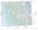
Maps showing East Arm Smith Inlet, Range 2 Coast Land District, British Columbia
East Arm Smith Inlet is a Bay located in Range 2 Coast Land District, British Columbia.
- Latitude: 51° 22' North (decimal: 51.3666999)
- Longitude: 127° 6' West (decimal: -127.0999999)
- Topography Feature Category: Bay
- Geographical Feature: Inlet
- Canadian Province/Territory: British Columbia
- Location: Range 2 Coast Land District
- GPS Coordinate Locator Map: East Arm Smith Inlet Lat/Long
East Arm Smith Inlet NTS Map Sheets