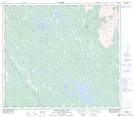
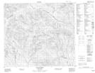
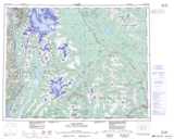
Maps showing East Kispiox River, Cassiar Land District, British Columbia
East Kispiox River is a River located in Cassiar Land District, British Columbia and has an elevation of 1243 meters.
- Latitude: 55° 50' 45'' North (decimal: 55.8458333)
- Longitude: 128° 36' 13'' West (decimal: -128.603611)
- Topography Feature Category: River
- Geographical Feature: River
- Canadian Province/Territory: British Columbia
- Elevation: 1243 meters
- Location: Cassiar Land District
- Atlas of Canada Locator Map: East Kispiox River
- GPS Coordinate Locator Map: East Kispiox River Lat/Long
East Kispiox River NTS Map Sheets