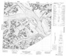
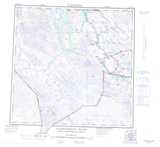
Maps showing Mount Forde, Cassiar Land District, British Columbia
Mount Forde is a Mountain located in Cassiar Land District, British Columbia.
- Latitude: 59° 1' 56'' North (decimal: 59.0322222)
- Longitude: 137° 10' 33'' West (decimal: -137.1758333)
- Topography Feature Category: Mountain
- Geographical Feature: Mount
- Canadian Province/Territory: British Columbia
- Location: Cassiar Land District
- Atlas of Canada Locator Map: Mount Forde
- GPS Coordinate Locator Map: Mount Forde Lat/Long
Mount Forde NTS Map Sheets