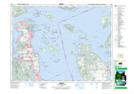
Maps showing Eagle Beach, Lake Land District, British Columbia
Eagle Beach is a Beach located in Lake Land District, British Columbia and has an elevation of 76 meters.
- Latitude: 48° 31' 35'' North (decimal: 48.5263889)
- Longitude: 123° 23' 17'' West (decimal: -123.388056)
- Topography Feature Category: Beach
- Geographical Feature: Beach
- Canadian Province/Territory: British Columbia
- Elevation: 76 meters
- Location: Lake Land District
- Atlas of Canada Locator Map: Eagle Beach
- GPS Coordinate Locator Map: Eagle Beach Lat/Long