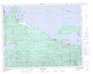
Maps showing Patrician Cove, Rupert Land District, British Columbia
Patrician Cove is a Bay located in Rupert Land District, British Columbia.
- Latitude: 50° 43' 30'' North (decimal: 50.7249999)
- Longitude: 127° 25' 0'' West (decimal: -127.4167000)
- Topography Feature Category: Bay
- Geographical Feature: Cove
- Canadian Province/Territory: British Columbia
- Location: Rupert Land District
- Atlas of Canada Locator Map: Patrician Cove
- GPS Coordinate Locator Map: Patrician Cove Lat/Long
Patrician Cove NTS Map Sheets